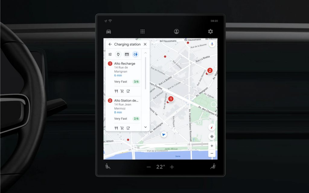
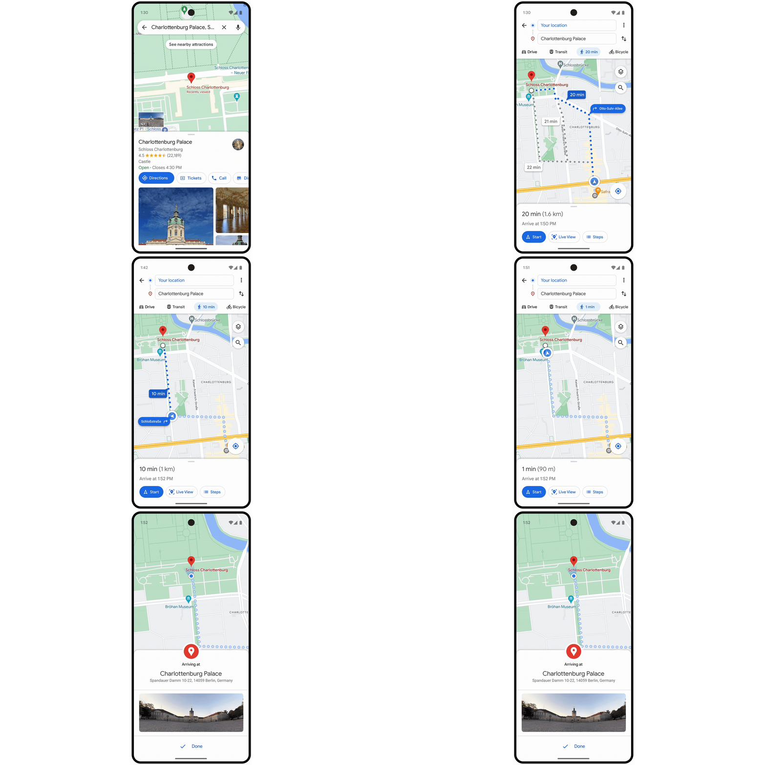
Google has revealed some updates coming to Google Maps in the coming months, adding new ways to explore the world. In particular, the changes will help those driving an electric vehicle, letting them find charging stations in an easier and more intuitive manner.
EV charging suggestions, DC fast charging filter

If your travel requires a charging stop, Google Maps will soon suggest one that’s most convenient, based on factors like current traffic, charge level and expected energy consumption. You will be able to switch to a different charger if you so wish, through just a few taps. The displayed route time will also include the required charging time.
Searching for stations has also been made easier with the addition of a “very fast” filter, which will only show DC fast charging stations with an output of 150kW or higher. Also, if you search for any point of interest, the results will include charging stations as well.
But there’s a catch—these features will only be rolled out to cars fitted with Google Automotive Services (GAS), which Google calls “Google built-in”. These are vehicles that not only built on the Android Automotive platform but also include Google’s apps like Google Maps and the Play Store. In Malaysia, the only electric vehicles with Google built-in are the Volvo XC40 and C40 Recharge EV.
Finally, support for Live Activities in iOS 16

Apple’s Live Activities feature was rolled out starting in iOS 16.1, enabling background activities like Apple Maps directions to show up on the lock screen and the iPhone 14 Pro‘s Dynamic Island. Although this functionality has been opened up to third-party developers, Google has been dragging its feet in implementing it into Google Maps, but this will come to an end in the coming months once the app has been updated.
Up-to-date route overviews while travelling

Another feature that’s being added is a route preview that updates as you travel. Previously, you’d only get up-to-date ETAs and turn-by-turn instructions once you’ve selected the route and entered comprehensive navigation mode, but this information will now be shown in real time even in the overview screen. That means you will be able to continue seeing your other route options while you’re walking, riding, driving or taking public transport, and this preview will even be recalculated if you decide to take a different route.
Immersive view and improved AR
One big new feature Google is rolling out is “immersive view”, which is essentially a supercharged version of Apple Maps’s Flyover, letting users check out entire cities in 3D. What’s different with Google’s offering is the ability to view buildings at different times of the day and even see what the weather will be like. You’ll even be able to explore nearby restaurants, including their insides.
The company created these 3D representations using an AI technique called neural radiance fields (NeRF), fusing “billions of Street View and aerial images” to recreate lighting, textures and backgrounds. Immersive view rolls out today in London, Los Angeles, New York, San Francisco and Tokyo, expanding to more cities such as Amsterdam, Dublin, Florence and Venice in the coming months.

Additionally, Google is expanding its Live View augmented reality function, which shows POIs like ATMs, restaurants, parks and train stations when you lift your phone up. You’ll be able to check if a place is open, if it’s busy right now and how highly it’s rated. This functionality was recently launched in London, Los Angeles, New York, Paris, San Francisco and Tokyo and will be expanded to Barcelona, Dublin and Madrid, again in the next few months.
Indoor Live View, which shows directions in the form of arrow overlays, will also be added to over 1,000 new airports, train stations, and malls in Barcelona, Berlin, Frankfurt, London, Madrid, Melbourne, Paris, Prague, São Paulo, Singapore, Sydney and Taipei. This feature was initially launched in 2021 in the US, Zurich and Tokyo.
0 comments :
Post a Comment